Coordinator: Mike W
Type of Ride: Backroad Advanced (or Intermediate with eBike)
Distance: 58-70km
Cumulative Elevation Gain: 1100-1400m
Anticipated Pace: 15-18 km/hr overall, slower uphill, faster downhill
Duration: Short Route: 5-6 hours moving time, 6½-7½ hours including stops. Long Route: 6-7 hours moving time, 8-9 hours including stops.
We will regroup at intersections or every 15 minutes. No one will be left behind.
PLEASE ARRIVE 15 MINUTES PRIOR TO START TIME TO GET YOU AND YOUR BIKE READY
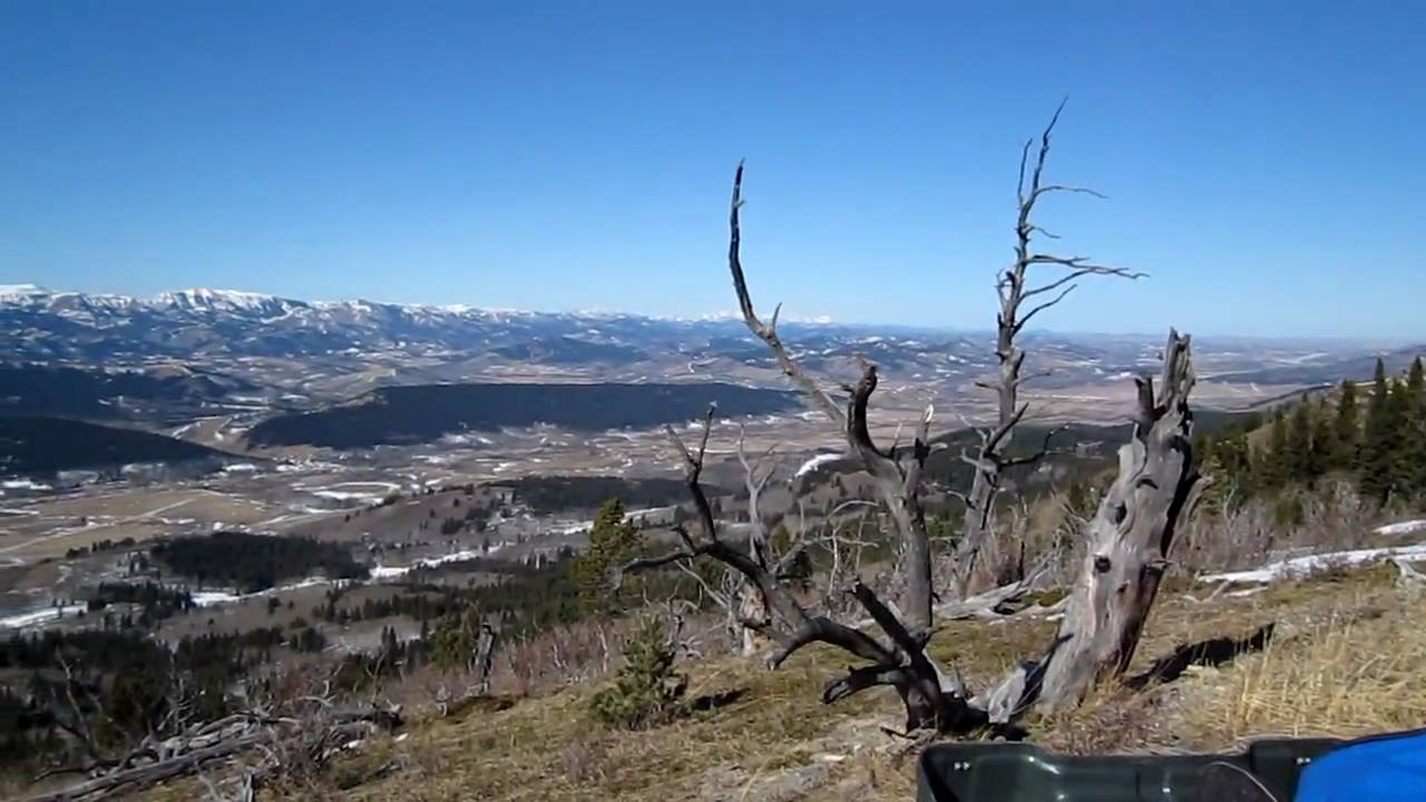
This is a 58-70km backroad loop starting and ending at the intersection of Hwy 520 & Lyndon Creek Rd, about 22km west of Claresholm. We'll be cycling through ranchlands with expansive mountain views from open ridges along the Porcupine Hills. All of it is on gravel and dirt roads. After 37km and 1050m elevation gain into the route, we can return to the start point via a longer route (32km and 350m elevation gain), or a shorter route (21km and 50m elevation gain). The longer route has the best scenery and riding of the day though! We can split up if there are at least two people on each route. See the maps below. There are no facilities along the entire route. You'll need to bring all the water and food you'll need for the entire trip. There are no facilities where we park. The closest are in Claresholm, about 22km east of our start point.
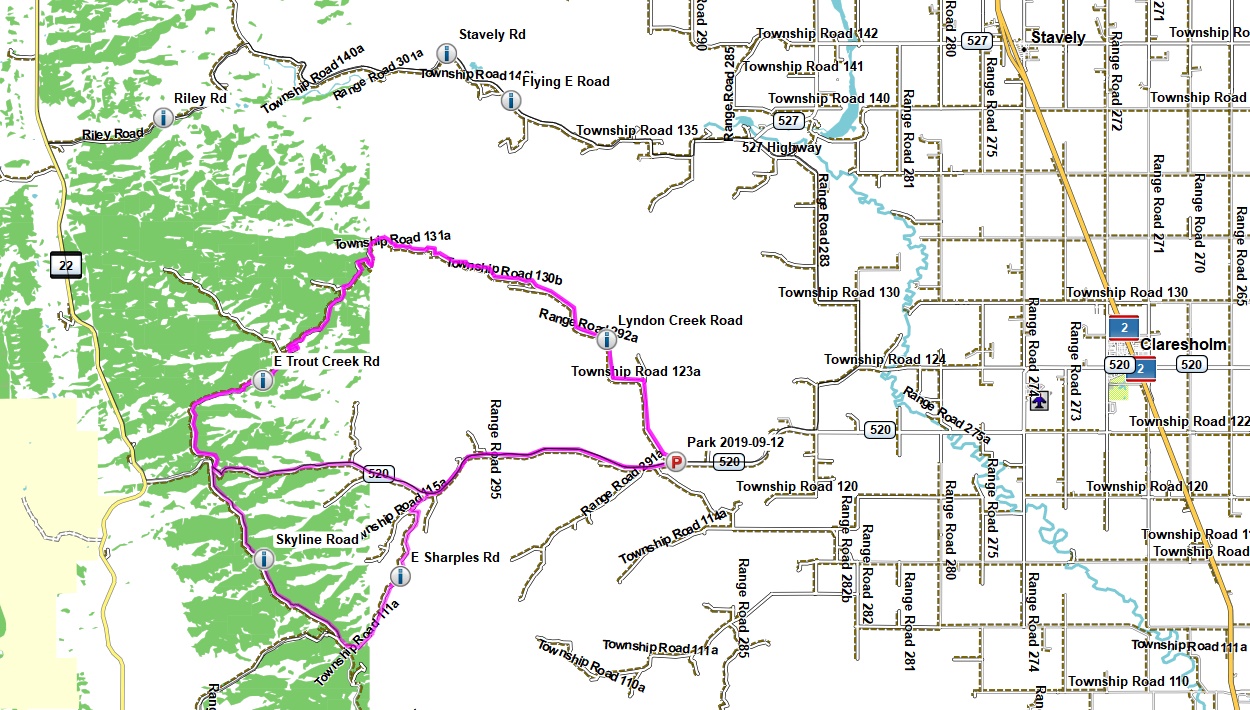
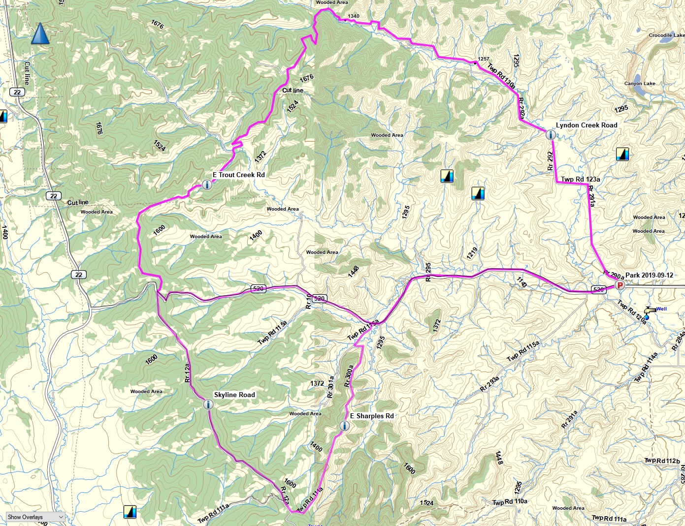
From our start point we head NW on Lyndon Creek Road for 20km, gently climbing 350m through ranchlands along Lyndon Creek.
We leave Lyndon Creek and head into the Porcupine Hills, turning SW onto East Trout Creek Road for 17km. We follow a series of rolling hills and ridges with lots of great views, until we reach the intersection with Hwy 520. There are several ups and downs on this section totalling 700m of ascent and 470m of descent at grades of up to 10%.
From here, the short route back is an easy ride along (gravel) Hwy 520 for 21km to our start point. It's only 50m of climbing with 600m of descent.
The long route crosses Hwy 520 and heads SE on Skyline Road to near an old fire lookout. Skyline Road lives up to its name by having great views across the Foothills to the Rockies. It's 11km of rolling hills with 200m of ascent and descent. This is followed by a fantastic 9km ridgeline descent NE along East Sharples Road, dropping 400m to Hwy 520. We then follow Hwy 520 for 14km back to our start point with 50m of ascent and 225m of descent.
This ride is suitable for bikes with tires that are at least 38mm / 1.5" wide, and some sort of tread pattern at least a couple of millimetres deep. Large lugged mountain bike tires are fine, but not required. The gearing should be set up for grades up to 10%. In general, this ride is suitable for gravel, cyclocross, hybrid, and mountain bikes, or any other bike with the necessary tires and gearing.
eBikes welcome!
Participants should ensure their bikes are in excellent condition and bring along more drink, food, clothing, safety, repair, and first aid gear than they would normally bring on a road ride. You should also bring bear spray. We will regroup at intersections or every 15 minutes or so, whichever is more frequent.